Overview
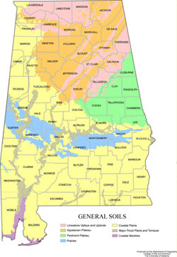
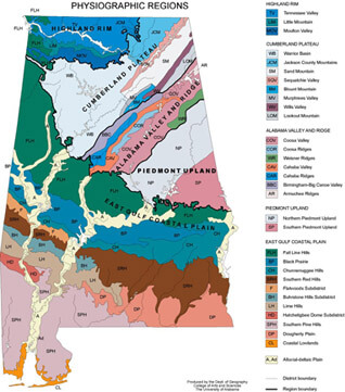
Wayne Flynt sketches the geographical and cultural regions of Alabama in the nineteenth and twentieth centuries.
Video
Part 2: Dr. Flynt offers an historical-geographical perspective on Alabama's economy from the antebellum era through 20th century
Part 3: Dr. Flynt discusses the importance of a sense of place to "Alabamians," highlighting the good and bad of provincialism
Part 4: Dr. Flynt explores the failure of Alabama's political leadership
About the Speaker
Wayne Flynt, Distinguished University Professor at Auburn University and a leading authority on Alabama history and Baptist history in Alabama, was educated at Samford University, formerly Howard College (B.A.,1961) and Florida State University (M.S., 1962; PhD 1965). He has served as the President of the Southern Historical Society (2003-2004) and is currently the Editor-in-Chief of the new Online Encyclopedia of Alabama. Prof. Flynt has actively devoted his life to bringing the issues of history and poverty and their social impact to the forefront of the public's consciousness.
Wayne Flynt is the author of eleven books, including the Pulitzer Prize nominated Poor But Proud: Alabama's Poor Whites. His most recent book, Alabama in the Twentieth Century was awarded the 2004 Anne B. and James B. McMillan Prize. In 2004, his book Dixie's Forgotten People: The South's Poor Whites was re-issued. Prof. Flynt's books have won many awards, some multiple times, including: the Lillian Smith Award for Non-Fiction, the Alabama Library Association Award for Non-Fiction, Outstanding Academic Book from the American Library Association, and the James F. Sulzby, Jr. Book Award. He is co-author of Alabama: A History of a Deep South State, which was also nominated for a Pulitzer Prize.
Recommended Resources
Maps
 |
 |
| Alabama Soil Map | |
| Maps Courtesy of the University of Alabama Department of Geography | |
Links
Alabama Maps
http://alabamamaps.ua.edu/.
Historical and contemporary maps of Alabama from the collection of the University of Alabama Department of Geography.
The University of Alabama Center for Business and Economic Research: Alabama Maps
http://cber.cba.ua.edu/edata/maps/AlabamaMaps1.html.
A variety of socioeconomic and population maps from the Center for Business and Economic Research at the University of Alabama.
Alabama Agricultural Maps
http://alabamamaps.ua.edu/contemporarymaps/alabama/agriculture/index.html.
Maps of recent Alabama agricultural crops and trends.
The Rivers of Alabama
http://www.riversofalabama.org/.
This website examines Alabama watersheds individually and in-depth.
Alabama Scenic River Trail
http://www.nytimes.com/video/travel/escapes/1194816481935/alabama-scenic-river-trail.html.
Christopher Percy Collier, "Discovering Alabama From Its Watery Byway," New York Times, May 15, 2008.
Opening the longest water trail in a single US state. News story and kayaking video (4:57 min.).
Flynt, Wayne. Alabama in the Twentieth Century. Tuscaloosa: University of Alabama Press, 2004.
Meinig, D. W.Continental America, 1806-1867. Vol. 2 of The Shaping of America: A Geographical Perspective on 500 Years of History. New Haven: Yale University Press, 1993.
Rothman, Adam. Slave Country: American Expansion and the Origins of the Deep South. Cambridge: Harvard University Press, 2005.
