Overview
 |
 |
Lawrence N. Powell reviews two books about public space and the landscape of New Orleans.
Tremé: Race and Place in a New Orleans Neighborhood. By Michael E. Crutcher, Jr. (Athens, GA: University of Georgia Press, 2010)
Public Spaces, Private Gardens: A History of Designed Landscapes in New Orleans. By Lake Douglas (Baton Rouge: Louisiana State University Press, 2011)
Review
|
|
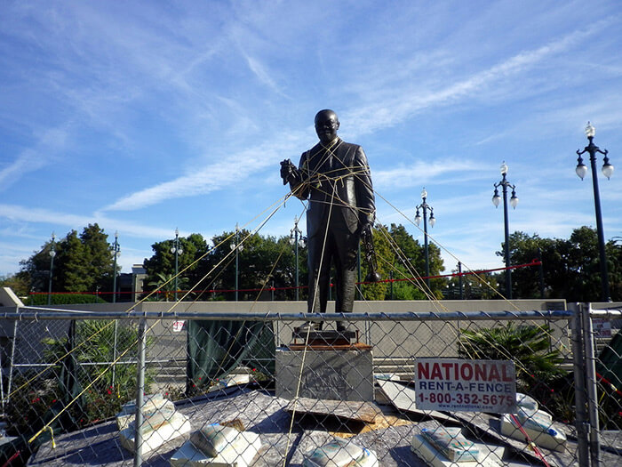
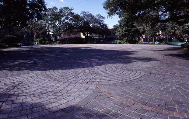
| Cory Doctorow, Roped-up Satchmo statue, Louis Armstrong Park, New Orleans, Louisiana, 2010. Area closed off since contractors poured pavement with bad cement and damaged the statue. |

Just across Rampart Street from the French Quarter lolls a thirty-acre pleasure garden and civic complex called Louis Armstrong Park. City fathers renamed it for New Orleans’s most famous native son in 1971 following the jazz giant's death in Brooklyn earlier that year. High-culture mandarins weren't bashful about voicing displeasure with the name change, insisting there were better places to celebrate “jungle music” than the site where a new theater for the performing arts was poised to arise. That kind of racial condescension never set well with Armstrong, who couldn't find lodging in the city’s segregated hotels for most of his life. When massive resistance raged against civil rights in the 1950s, he boycotted his hometown, returning only after the passage of the 1965 Voting Rights Act. But by the time of Armstrong’s death, racial politics in New Orleans had shifted on its axis. Not only was the park renamed in tribute to Satchmo, so in time was the theater of the performing arts rechristened for another towering figure in New Orleans musical history: the great gospel singer, Mahalia Jackson.
You don’t have to be an ethnomusicologist to appreciate why this sprawling park was chosen to memorialize jazz history. Congo Square, the fabled area where African slaves in the hundreds once gathered on a Sunday to vend vegetables and dance the Bamboula, squats in the park's southwestern corner, adjacent to the Municipal Auditorium. To jazz aficionados, it’s a spiritual site. Nowhere else in the urban South were slaves permitted to perform openly, merging the melodic and polyrhythmic traditions of myriad West African ethnicities in ways that would ever and anon irrigate mainstream music in America and the world.
 |
| Masahiro Sumori, Congo Square today, New Orleans, Louisiana, 2006. |
Sculptural tributes to New Orleans musical history greats are scattered throughout the park, most of them in bronze. There is a uniformed brass band striding down the main entranceway, while a life-size likeness of “Tootie” Montana, the chief of the Yellow Pocahontas in full Indian regalia, looks on.1Shortly before Hurricane Katrina, Montana collapsed and died in front of the city council while defending New Orleans’s Mardi Gras Indian traditions against police harassment. There is an iconic statute of Louis Armstrong clutching a trumpet in one fist and a sweat-soaked handkerchief in the other. There’s even a bronze likeness of Buddy Bolden in triplicate, whose cornet playing at the turn of the last century was so forceful you could hear its blast from miles away—until he went insane and had to be institutionalized.
The only thing missing are visitors. I counted six the day I strolled through the park. Unless you include the cleanup crew, local residents were scarcely seen.
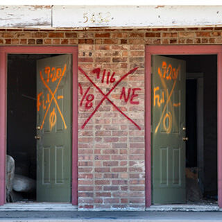
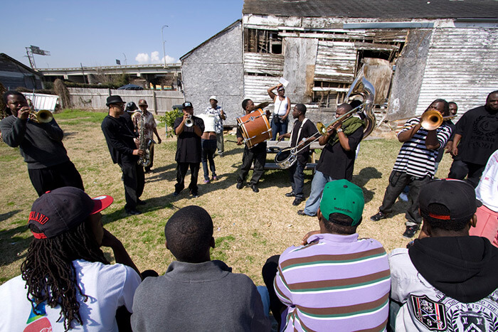
Michael E. Crutcher, Jr., in his compact history, Tremé: Race and Place in a New Orleans Neighborhood, blames their absence on the fact the space has been “erased,” “deterritorialized,” to use the argot of cultural geography. The erasure didn't obliterate everything. Some of the remains are visible from the footbridge straddling the park’s faux lagoon. The rows of paint-scabbed Creole cottages just beyond the chain link fence in the park’s rear hemming in acres of parking lots belong to the Tremé. The Tremé is one of the country’s oldest black urban neighborhoods and the subject of a current HBO series by the acclaimed creators of “The Wire.” The neighborhood’s contributions to jazz history are as rich as any place on the planet. Sidney Bechet (also immortalized here in bronze) grew up in these precincts. The second line parading tradition still thrives here. But, for the past half century, the Tremé has been under siege, hundreds of its homes razed and an untold number of residents displaced in the name of progress. Nor is its future unclouded.
 |
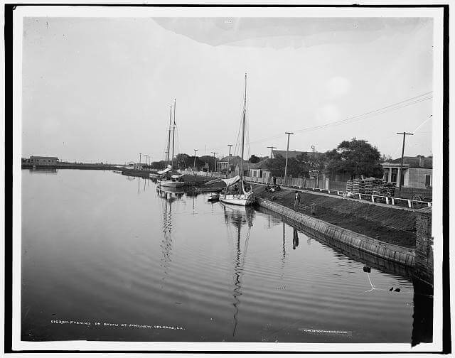
| Evening on Bayou St. John, New Orleans, between 1900 and 1906. Library of Congress, Prints & Photographs Division, Detroit Publishing Company Collection, LC-D4-16350. |
New Orleans has had an interesting experience with public spaces such as Armstrong Park. Many of these spaces are leftover tracts of land. No less engrossing is their history. According to Lake Douglas, author of Public Spaces, Private Gardens: A History of Designed Landscapes in New Orleans, and a landscape architect himself, “the evolution of the designed landscapes of New Orleans is unlike any other within American landscape history….” (2). Douglas’s claims for uniqueness start with the town’s semi-aquatic environment, which until the twentieth century confined most human settlement to the natural levees—those ribbons of land that had welted up along the Mississippi's banks as a result of eons of spring overflow. When the booming city spilled beyond the borders of the Vieux Carré, and sugar plantations above and below the original grid morphed into faubourgs (suburbs), the resultant streets and boulevards splayed out from the river’s curvature like so many bicycle spokes. Bending this strange terrain to the rules of geometry must have given surveyors fits. Douglas describes the messy aftermath: “With no legislation in place to govern how new neighborhoods were laid out, streets sometimes met at strange angles, and unbuildable plots became de facto public spaces scattered like remnants of green cloth on the tailor’s floor” (6). In time, local residents appropriated this serendipitous acreage, much as big city pedestrians today colonize selected high-rise building plazas for lunchtime schmoozing. Nineteenth-century New Orleanians even assigned individual names to these leftover lots.
They were also fond of commandeering, for recreational uses, strips of land that had surfaced as a result of unrelated urban actions. Such linear space was plentiful in New Orleans in the lush decades before the Civil War. The earthen berms built atop the natural levees to hold back spring floods come immediately to mind. Heaped with cotton bales and hogsheads of sugar, these manmade levees were famous for their babble of bustle and clamor. But sweltering urbanites also converted some sections into a “promenade and public living room,” to quote historian Mary Ryan (37). Much the same thing happened both to the walkway that emerged alongside the old Carondelet Canal, and to New Orleans's ubiquitous neutral grounds, as median strips are called in these parts. The Spanish had excavated the canal (also known as the Old Basin Canal) in the 1790s in order to connect the French Quarter directly with Bayou St. John. Filled in during the New Deal, in its heyday the Carondelet canal and its adjacent walkway not only facilitated lake commerce but enhanced “open-space awareness in nineteenth-century New Orleans” (42). As for those neutral grounds, they, too, were swiftly re-purposed by local residents into tree-shaded pedestrian walkways.
 |
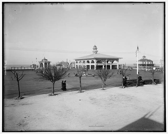
| West End pavilions, New Orleans, c 1900. Library of Congress, Prints & Photographs Division, Detroit Publishing Company Collection, LC-D4-10119 R. |
 |
| Eugène Surgi and Adrien Persac, Plan of Splendid Property and Two Fine Lots of Ground, Second District, March 12, 1860. Plan Book 005.018, New Orleans Notarial Archives. |
In the 1840s and ‘50s, New Orleans was a gateway to the Mississippi Valley for millions of Irish and German immigrants, tens of thousands of whom stayed put after debarking. The newcomers naturally hankered after fresh air diversions as well, which urban entrepreneurs by the dozens supplied in the form of pleasure gardens all over town. (Douglas has uncovered no less than twenty such between 1810 and 1900, a large number for a city of New Orleans’s size.) The concept of paid admission public gardens was a European import. Even the names were lifted from the continent: Vauxhall and Tivoli, for example, of which New Orleans boasted at least two apiece. Pleasure gardens sprouted along the Carondelet Walkway. When rail and streetcar lines enabled day travel to the lake and upriver stops such as Carrollton, the gardens established at the end of the line blossomed into weekend resorts. Three such paid admission sites cropped up on the lakefront alone: Milneburg, Spanish Fort, and West End, the latter a byproduct of the New Basin Canal (dug by American newcomers in the 1830s to tap into the lake trade). Some gardens, in addition to offering food and music, sported pistol galleries and archery ranges. Most of all, they catered to select ethnic clientele. Thus there was a Fassnacht German beer garden as well as an outdoor pleasure park named for the Polish nationalist, Louis Kossuth. There were ornamental French gardens of Euclidean beauty, and English gardens that imitated nature instead of trying to improve it. Other gardens, by setting aside two days a week for the patronage of free people of color and/or women, registered contemporary racial and gender proprieties. But, this being New Orleans, lots of illicit mixing occurred in these entertainment venues anyway.
Public Spaces, Private Gardens is packed with a plenitude of delicious information. There are chapters laying out the history of the city’s best known squares—Jackson, Lafayette, and Washington, even the trapezoidal Coliseum Square—and useful accounts of how and when the town’s multitudinous vegetable patches gave way to ornamental gardens. Douglas rescues from neglect the lost history of nursery catalogs, gardeners, and florists, not to mention how-to gardening books. In the appendix you’ll even find an extensive listing of ornamental plants. The folio reproduction of watercolor drawings of plots and houses selected from the city’s Notarial Archives alone is worth the price of the book.
If the stretch marks of ecology and ethnicity are easy to spot in the city’s public spaces, the same can’t be said of the politics of park design. They have to be dragged from the muck of history. Douglas has a practiced eye for their symptomatic characteristics—the endemic corruption, fiscal parsimony, and municipal dysfunction that are hallmarks of our famously fractured civic culture. Distrust of government and an aversion to paying taxes were big reasons New Orleans never got around to paving its streets and sprucing up the neutral grounds until the 1890s. It was why the city failed to convert its neutral grounds and other linear spaces into an “Emerald Necklace” such as Frederick Law Olmsted designed for Boston in the 1880s. And it explains not only the later arrival of New Orleans’s two major urban parks—Audubon Park and City Park—but why they entered through the back door. Douglas sums it thus: “when nineteenth-century park improvements did occur, they were initiated by single-interest support groups composed of adjacent property owners and, for the most part, were independent of municipal control or oversight” (45). But don’t mistake this outsized influence of private initiative on public policy as neighborhood voluntarism writ large. It bespeaks an ingrained cultural resistance to giving tax money to governments answerable to working-class voters. That attitude is still embalmed in the bevy of quasi-public appointive boards and commissions that constitute much of the governance in modern-day New Orleans. It’s an example of democracy attenuated.
 |
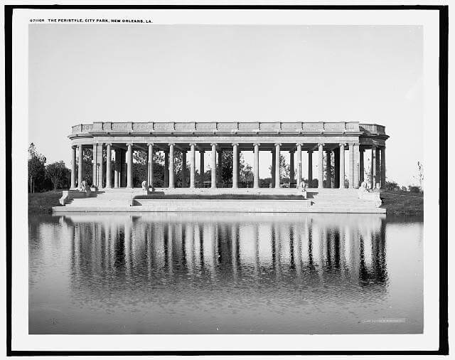
| The Peristyle, City Park, New Orleans, Louisiana, between 1901 and 1910. Library of Congress, Prints & Photographs Division, Detroit Publishing Company Collection, LC-D4-71106. |
City Park is a good place to watch how New Orleans makes sausage. City Park is the one that stretches alongside Bayou St. John from Metairie Ridge almost to the lake, the landscaped green space with the peristyle and the casino, and the majestic driveway that leads to the New Orleans Museum of Art. A racetrack once occupied its vast woody grounds. A football stadium and golf course still do, along with a botanical garden and concrete-lined lagoons, one of which deliberately resembles a miniaturized replica of Lake Pontchartrain. The first major park to be authorized by the city, City Park was also the last to be built. Here’s the timeline: in 1858, the city received full title to this once-upon-a-time plantation; in 1872, New Orleans contracted with two landscape architects formerly with Olmsted’s firm to draw up a plan for the park; in 1873, the architects sued the city for breach of contract; finally, in 1893, prominent civic leaders organized “a private non-profit corporation,” which acquired state permission to manage the property (47). At last, serious strides were made to convert the undeveloped land into a honest-to-goodness park. Even then, City Park, in all of its present-day City Beautiful and art deco magnificence, never reached triumphal fulfillment until the New Deal’s WPA stepped in to accomplish what the city never would or could.
 |
| Thomas Hunter, World's Industrial & Cotton Centennial Exposition at New Orleans, Louisiana, 1884. Library of Congress, Prints & Photographs Division, Popular Graphic Arts Collection, LC-DIG-pga-01657. |
 |
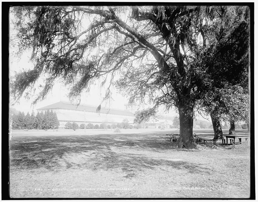
| Horticultural hall, Audubon Park, New Orleans, between 1890 and 1901. Library of Congress, Prints & Photographs Division, Detroit Publishing Company Collection, LC-D4-5742. |
Conceived in bribery and swaddled in corruption, Audubon Park followed an even rockier passage into sylvan existence. There was its inception in a land-jobbing scheme by two northern speculators during Reconstruction who bought gone-to-seed plantations for a song and then resold them promptly to the state for a king’s ransom—only to have the underlying state bond issue repudiated by a Democratic legislature after Reconstruction was forcibly overthrown. There was the larger financial failure a few years later of the 1884 World’s Industrial and Cotton Centennial Exposition, when a torrent of money was poured into draining the land and erecting exhibition halls, on the overhyped projection the fair would attract four million visitors. A mere one-quarter of that number showed up, whereupon the state treasurer—and the exposition’s chief booster—fled to Honduras when his accounts were discovered $1.7 million in arrears. Next followed a familiar scenario: circumventing city government, civic-minded business leaders secured effective control of this public space and turned to private fund-raising, including the sort of paid-admission amusement pioneered by nineteenth-century pleasure gardens, to defray capital improvements and operating costs. At a time when city governments elsewhere in America were floating million-dollar bond issues—and more—to create City Beautiful urban parks, the low-tax culture of New Orleans could barely scrape together enough money to finance even meager park improvements. Eventually, under the architectural guidance of Frederick Law Olmsted’s stepson, Audubon Park was landscaped into the oak-lined enclave that it is today.
 |
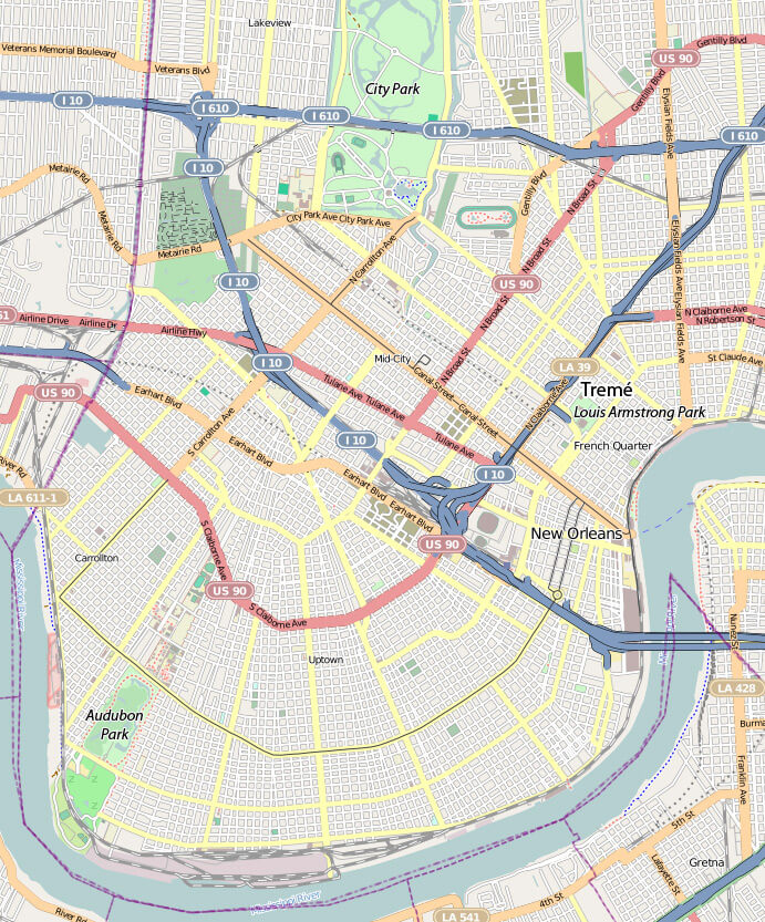
| New Orleans map showing Louis Armstrong Park in Tremé, City Park, and Audubon Park. ©OpenStreetMap contributors, CC-BY-SA. |
 |
| Map of the Neighborhood of Tremé. ©OpenStreetMap contributors, CC-BY-SA. |
It would be hard to come up with a better illustration of how politics guided New Orleans’s spatial evolution than the tortured history of the Tremé and Congo Square. Maybe that’s why Michael Crutcher, an assistant professor of geography at the University of Kentucky, spends more time limning the politics of “oppositional communities” in the Tremé than mapping its geography. (Astonishingly, there is not a single map in this short book, not even of the Tremé. To get their bearings, readers have to search for online maps.) Crutcher is correct to remind us that this historic community was never monolithic but has always been a place of racial and social diversity. The community’s iconic church, St. Augustine, for example, founded by free people of color in 1842, administered sacraments to congregants black and white, slave and free. Still, the Tremé has been closely identified with Afro-Creoles. Faubourg Tremé, like Faubourg Marigny, had been a functioning plantation before being subdivided into homesteads for the thousand of Haitian refugees boatlifted to New Orleans in 1809–10 following a brief exile in Spanish Cuba. As well-known as the Tremé’s contributions are to jazz, no less significant is its place in the Afro-Creole protest tradition. Homeré Adolphe Plessy, who is best remembered for losing the US Supreme Court case that made segregation constitutional in 1896, was a shoemaker and political activist from the Tremé, as well as a congregant of St. Augustine Church.
For most of the twentieth century, though, this neighborhood has been under intermittent assault from backhoes and bulldozers. To tourists, New Orleans sells itself as “The City that Care Forgot.” But this marketing gimmick has often rung hollow in the Tremé, where city hall has seldom cared enough. The purposeful neglect began not long after a 1919 fire destroyed the French Opera. Within a decade the city hall condemned a square block of the Tremé in order to build Municipal Auditorium, from which black residents were excluded until 1953 (and then confined thereafter to segregated seating until the feds outlawed racial discrimination eleven years later). Another “slum clearance” took place following the passage of the U.S. Housing Acts of 1949 and 1954, causing the razing of more homes and historic structures. Then there was the tsunami of “deterritorialization” that swept over the Tremé in the early ‘sixties to make room for the aforementioned theater for the performing arts and an elevated expressway down the middle of South Claiborne Avenue. (The plans for the expressway had been drawn up in the 1946 by the legendary master-planner from New York City, Robert Moses.) South Claiborne was the “retail spine” of Tremé, an alternative to the segregated emporiums of Canal Street. And its neutral ground had become the community’s green space, to say nothing of a rendezvous for downtown Mardi Gras Indians on Fat Tuesday. Almost overnight five hundred live oaks went under and an expressway went up, bathing a linear park in the near total eclipse of a concrete overpass.2There has been some talk of tearing down the elevated stretch of I-10 above South Claiborne. Meanwhile, white preservationists—to their everlasting credit, it must be conceded—were thwarting a similarly misconceived plan to build a riverfront expressway in front of Jackson Square. But no one came to the defense of the Tremé, the city’s soul.
 |
| David Bridges, K-Boo's jazz funeral, Tremé, New Orleans, Louisiana, February 19, 2011. |
Whither the Tremé today? According to Crutcher the clear and present danger going forward is gentrification—but from black gentrifiers. In Crutcher’s eyes, the historic preservation movement, whose “architectural fetishism” would empty a neighborhood in order to rehab a building, has a lot to answer for. He has a point—but only up to a point. Few people would deny that the aesthetic conflicts pitting middle-class gentrifiers against social and pleasure clubs over orderly streets signal trouble ahead. But Crutcher carries a good argument much too far when he asserts a fundamental conflict between neighborhood revitalization and the rich performative culture of New Orleans neighborhoods such as Tremé. Does he really believe that improving living conditions of the economically disadvantaged can happen only at the expense of deeply rooted festival traditions?
As for Congo Square, its history has been no less checkered, dating as far back as the 1840s when city authorities forbade further outdoor slave performances. In the 1880s the square even lost some of its historic identity when it was renamed for the Creole Confederate general, Pierre Gustave Toutant Beauregard. Yet, nothing that occurred during Congo Square’s first 150 years of existence quite matches the park’s byzantine history since the 1960s. Making sense of a forty-year saga of failure and stalemate is far from easy. There’s been a more or less constant whirligig of contention involving uptown white elites, a newly-aroused Tremé community, and antagonistic pro-growth factions of Afro-Creole politicians. They have fought about park management and drawn swords over whether a Tivoli-like paid-admission amusement venue should be allowed in. Until the National Park Service took over in 1999, forward progress had pretty much come to a standstill. But for most of the time since then Armstrong Park has been under lock and key and closed to the public. The sparse attendance on the day I visited two weeks after its reopening doesn’t augur well for the future.
Recommended Resources
Bullard, Robert D. and Beverly Wright, eds. Race, Place, and Environmental Justice After Hurricane Katrina: Struggles to Reclaim, Rebuild, and Revitalize New Orleans and the Gulf Coast. Boulder, CO: Westview Press, 2009.
Campanella, Richard. Time and Place in New Orleans: Past Geographies in the Present Day. Gretna, LA: Pelican Publishing, 2002.
Campanella, Richard. Bienville's Dilemma: A Historical Geography of New Orleans. Lafayette: Center for Louisiana Studies, University of Louisiana at Lafayette, 2008.
Colten, Craig E., An Unnatural Metropolis: Wresting New Orleans From Nature. Baton Rouge: Louisiana State University Press, 2005.
Evans, Freddi Williams, Congo Square: African Roots in New Orleans. Lafayette: University of Louisiana at Lafayette Press, 2011.
Forman, L. Ronald, and Joseph Logsdon with John Wilds; photographs by David King Gleason and David Kleck, Audubon Park: An Urban Eden. Baton Rouge, LA: D.K. Gleason/Friends of the Zoo, 1985.
Lewis, Peirce Fee. New Orleans: The Making of an Urban Landscape. Charlottesville: University of Virginia Press, 2003.
Powell, Lawrence N. The Accidental City: Improvising New Orleans. Cambridge: Harvard University Press, forthcoming 2012.
Reeves, Sally K, William D. Reeves with Ellis P. Laborde and James S. Janssen, Historic City Park, New Orleans. New Orleans, LA: Friends of City Park, 1982.
Starr, S. Frederick. Southern Comfort: The Garden District of New Orleans. New York: Princeton Architectural Press, 2005.
Sublette, Ned, The World That Made New Orleans: From Spanish Silver to Congo Square. Chicago: Lawrence Hill Books, distributed by Independent Publishers Group, 2008.
Links
Official Website of the documentary Faubourg Tremé: The Untold Story of Black New Orleans
http://www.tremedoc.com/.
Official Website of the television show Tremé
http://www.hbo.com/treme/.
